Thu,Sep 18,2014
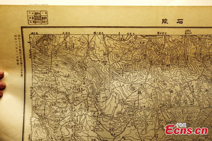 |
| An employee of Administration of Surveying, Mapping and Geoinformation of Central China’s Henan province shows a military map drawn by Japanese army during the Japanese war of aggression against China on Wednesday, September 17, 2014. The detailed topographical map of China is marked with a measuring scale of 1:50,000. The map is exhibited to commemorate the 83rd anniversary of the "9.18 Incident," or "Mukden Incident," which marks the beginning of the 14-year war against Japanese aggression. On September 18, 1931, Japanese troops blew up a section of the railway under their control near Shenyang, and then accused Chinese troops of sabotage as a pretext for attack. They bombarded barracks near Shenyang the same evening, beginning a large-scale armed invasion of northeast China. [Photo: China News Service/ Wang Zhongju] |

 Female Top Guns have display dates
 Leading director Wang Quan'an detained for 'buying sex'
 PLA navy conducts live fire drill in East China Sea
 Top 10 Chinese actresses with pretty face
 Say cheese, kittens and puppies!
 Top 10 Chinese goddesses selected by S. Korean media
 Going back to Three Kingdoms Period in Zhaohua ancient city
 Most amazing chi-pao beauties
 Xisha Islands welcomes first visitors
 Special thanks to special teachers
Day|Week|Month


