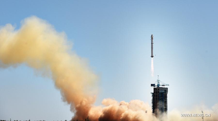
A Long March-2D carrier rocket carrying the Gaofen-9 satellite, a high-definition earth observation satellite, blasts off from the launch pad at the Jiuquan Satellite Launch Center in Jiuquan, northwest China's Gansu Province, Sept. 14, 2015. It will be used for land surveys, city planning, crop yield estimates and disaster prevention. (Xinhua/Zhao Yingquan)
JIUQUAN, Gansu, Sept. 14 -- China on Monday launched its most sophisticated observation satellite, Gaofen-9, as part of the country's high-definition Earth observation project.
Gaofen-9 was launched from the Jiuquan Satellite Launch Center in the northwestern province of Gansu at 12:42 p.m. aboard a Long March-2D carrier rocket. It was the 209th flight of the Long March rocket series.
The optical remote sensing satellite is capable of providing photographs with a resolution of less than a meter. It will be used in land survey, urban planning, road network design, agriculture, and disaster relief.
Developed by the Shanghai Academy of Spaceflight Technology, Gaofen-9 can also serve key national strategies such as the Belt and Road Initiative and national defense.
Gaofen-1, the first satellite of the lineage, was launched in April 2013.
 |
Day|Week

 Have you met her? Campus belle from Wuhan University
 Expert reveals top five longevity acupuncture points
 China Will Never Accept Dala Lama’s “Middle Way”
 Villagers Loot Ten Thousand chicks from Overturned Truck in Shandong
 PLA builds 500m pontoon bridge in 15 minutes
 Aerial photos of highways in the 'Mountain City'
 The only female soldiers' formation at China's V-Day Parade
 Asia’s largest glass viewing platform to open soon

