 |
With the completion of its first base station in Vientiane, China’s BeiDou Navigation Satellite System has officially arrived in Laos.
With support from the National Administration of Surveying, Mapping and Geoinformation of China, Laos's satellite navigation system, which was built using the same blueprint as China’s BeiDou Navigation Satellite System, has formally begun operation.
The system is compatible with the Continuous Operational Reference System (CORS) of the BeiDou Navigation Satellite System, GPS and GLONASS. It provides users across Laos with positioning and timing services. Construction of the base in Vientiane was completed on Aug. 1, and it passed the technical test right away.
The BeiDou Navigation Satellite System is one of four satellite navigation systems in the world. The other three systems are GPS (U.S.), GLONASS (Russia) and Galileo (Europe).
 Spectacular bridge with one of the tallest piers in the world
 Magnificent view of Hukou Waterfall
 A glimpse of Stride 2016 Zhurihe B military drill
 US Navy chief tours Liaoning aircraft carrier
 Chinese American woman wins Miss Michigan
 Centenarian couple takes first wedding photos
 Traditional Tibetan costumes presented during fashion show
 How did ancient people escape the summer heat
 Breathtaking scenery of Hulun Buir grassland
 Top 10 livable Chinese cities
 Top 20 hottest women in the world in 2014
 Top 10 hardest languages to learn
 China’s Top 10 Unique Bridges, Highways and Roads
 Rio Olympics deserves applause from us
 Experts doubt Batie practicality
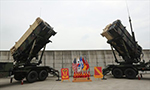 US eye in South Korea
 Expats in China are drawn to the customs and cultural togetherness brought about by Chinese munchies
Day|Week

