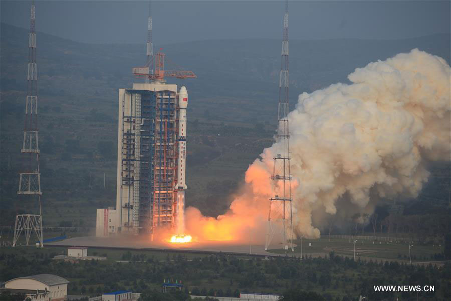
A Long March 4C rocket carrying a new high-resolution Synthetic Aperture Radar (SAR) imaging satellite blasts off at the Taiyuan Satellite Launch Center in Taiyuan, capital of north China's Shanxi Province, Aug. 10, 2016. As China's first SAR imaging satellite that is accurate to one meter in distance, it covers the globe with an all-weather, 24-hour observation service and will be used for disaster warning, weather forecasting, water resource assessments and protection of maritime rights. [Photo: Xinhua]
 |
Day|Week

 Who Will Fit The Chinese Roles In Game Of Thrones?
 China's Hubei Shennongjia added to World Heritage List
 Cute Dog At Fruit Stand Becomes Latest Internet Sensation
 Thai most beautiful transgender Nong Poy release new photos
 Top 10 livable Chinese cities
 The last primitive tribe in China
 China's first intelligent security robot debuts in Chongqing
 A Total of 3,552 Subscribers Vanish In Two Days; YouTube Closes All Doors to Users’ Inquiries
 Out of this world! Futuristic UFO-shaped yacht has its own garden and a stunning underwater viewing deck
 An old tea house in Chengdu

