 |
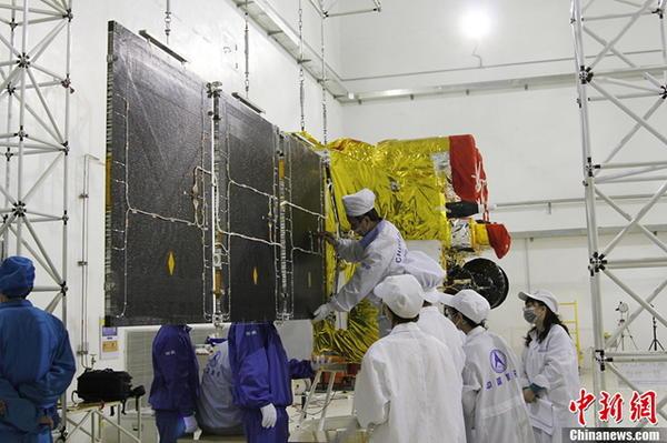
CHANGCHUN -- Northeast China's Jilin Province plans to send Jilin-1, the country's first self-developed remote sensing satellite for commercial use, into space in October, its designers said Tuesday.
Jilin-1 consists of four satellites, one for high-definition images, one for testing new space technology and another two for video, said Xuan Ming, board chairman of Chang Guang Satellite Technology Co., Ltd under the Changchun Institute of Optics, Fine Mechanics and Physics, Chinese Academy of Sciences.
The satellites will focus on providing photographs to commercial clients, while helping with harvest assessment, geological disaster prevention and resource surveys, Xuan said.
Jilin, one of the country's oldest industrial bases, is developing its satellite industry as a new economic drive. The province plans to launch 60 satellites by 2020 and 137 by 2030.
 Beauty of Tsinghua University transforms into car model
 Mums stage breastfeeding flash mob
 Moscow “spider-man” climbs Chinese skyscraper
 No cleavage allowed at China’s largest gaming expo this year
 Photo story: A model’s breast implant surgery
 Student proposes during graduation ceremony
 Kiss contest held in Nanning, SW China
 Bikini beauties lifeguards in river rafting place
 An unbreakable army
 Sharing with strangers
 US cyber ‘retaliation’ shows hypocrisy
 Markets fall again despite govt support
 China’s police dogs train to sniff out crime
Day|Week